vsTASKER has been used in some ATC simulation since it support ARINC 424 format and flight-plan definitions.
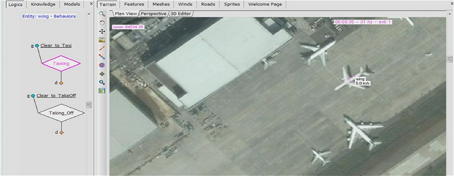
With the Map-on-Demand capability (online and offline), it is possible to setup a realistic God-Eyes-View simulation on any airport of the word by just setting the terrain view on a particular area, draw or import ground taxi-lines, SID and STAR procedures, define flight-plan for departing and approaching aircraft, timetables (…) and build a complete airport tower simulator.
Using vsTASKER GUI map, it is possible to follow an aircraft from taxi to cruising altitude. With an OSG 3D viewer, or any other IG using DIS, CIGI or bespoke API, user can get a real view of the area from any perspective. Latitude, longitude and spherical trigonometry are used for all computations for perfect accuracy with the real world.
For the dynamic models of aircraft, linear models are good enough for 2D maps with plausible results.
High fidelity dynamic models can be used along with proper parameters to accurately matches aircraft performances and provide realistic 3D visual feedback. Some projects have replaced the built-in dynamic models with their own Simulink models since vsTASKER can import them directly into its simulation engine.
Wind data can also be imported into the scenario. HMI builder becomes very convenient to create specific control stations with radar views, map and terrain overlay, strips and point and click orders.
ADS-B has also been used to mix real traffic with simulated one for training purpose.
Similar projects:
- UAV with complex flight-plans
- ATC control panel for training
- Flight-Plan validation
- ADS-B incrustation
- Airport Visual System population